
Trace an Abilene Street Address
Start with the address as it is written, but be ready to test the form used by the property portal. A street search can establish a parcel, an appraisal owner clue, a deed trail, and older directory references. It cannot establish a complete household. Taylor Central Appraisal District, the City of Abilene map, the Taylor County Clerk index, and historical directories each answer a different part of the question. Treat a name on one result as a lead to check in the next source.
- Enter the street number and street name in Taylor CAD Property Search. Retain a unit number in notes, but test the portal's simplified convention first.
- Record the account or property ID, geographic ID, situs address, owner display, mailing address if shown, legal-description clue, and tax year.
- Open the City of Abilene GIS viewer for civic context, then note each nearby parcel separately.
- Search the owner as grantee or grantor in Taylor County Tyler Super Search. Read the latest deed and use its legal description to move backward.
- For older household clues, compare the address and cross streets in an Abilene directory. A lawful Texas voter-data request can add a registered-voter row, but it is not a reverse-address roster.
The chain is strongest when the parcel ID, legal description, and recording information agree. The owner display alone is not the end of the Abilene street directory search.
Use Taylor CAD Street Fields
Taylor CAD is the practical first stop for a current Abilene street directory search. Its portal offers owner, address, ID, Advanced, and ARB Search modes. The district instructs address users to enter the street number and street name without directional prefixes, suffixes, or unit numbers. If a full street name fails, the first few letters may work. The address result remains an appraisal record, so its legal description and acreage are not a substitute for a survey or recorded deed.
| CAD field | Entry type | Needed? | Abilene street use |
|---|---|---|---|
| Street Number | Text | Optional | Enter the numeric component. |
| Street Name | Text | Optional | Omit prefix, suffix, and unit; first letters may work. |
| Owner Name | Text | Optional | Use last name first name and try spelling variants. |
| Property ID | Text | Optional | Use the exact account/property clue when known. |
| Geographic ID | Text | Optional | Use the exact GIS identifier when known. |
| Subdivision / Neighborhood | Autocomplete | Optional | Choose a listed area to narrow an Abilene street result. |
| Tax Year | Dropdown | Optional | The static inspection did not expose the complete year list. |
CAD's 2026 values are certified, but the district asks users to verify its information. Use the CAD card to find identifiers and then turn to the clerk for the recorded instrument.
Note: The inspected portal did not expose a live parcel-result schema, so capture each displayed field rather than assuming its placement or availability.
Map Abilene Streets With Context
The city GIS viewer adds geography that a CAD search does not fully explain. City Planning lists map subjects for city limits, the extraterritorial jurisdiction, county boundaries, present and future land use, super-neighborhood boundaries, corridor overlays, and the Carver neighborhood plan. Those layers can show whether nearby parcels share a civic area or sit near a boundary. They do not create a street roster or prove who occupies each parcel.
The public web-app inspection did not expose live address-search fields, the identify-button label, popup order, or owner fields. Record the source date and enabled layers when using a live map. If an existing GIS or administrative record is not available online, request it through the City's public-information procedure, rather than asking for a new survey.
Abilene Street Records by Address
Address-keyed sources differ in both coverage and meaning. A parcel and owner clue from CAD can be paired with a deed, a city activity record, or a historic directory entry. The table keeps those roles distinct so a street directory result is not overstated.
| Address source | Custodian | What it contributes | Abilene access route |
|---|---|---|---|
| Property search | Taylor CAD | Parcel, owner/property clue, situs and mailing distinction | Free online search or CAD office |
| GIS and downloads | Taylor CAD / City GIS | Parcel geometry, civic context, planning layers | Free viewer or data-download page |
| Official property records | Taylor County Clerk | Deeds, plats, liens, restrictions, releases, legal description | Tyler index, terminals, copy request |
| Address activity | City of Abilene | Permit, inspection, occupancy, code, or report activity | MyGov, city request, or Building Inspections |
| Voter file | Texas Secretary of State | Registered-voter row, precinct, and governed residence fields | Paid county/precinct request process |
| Directories and newspapers | Library and partner collections | Historic household, business, cross-street, and date clues | Library, UNT, microfilm, and databases |
For current building or code activity, the MyGov Address Lookup advertises activity at a location, although its form fields were not exposed in the research inspection. Its public landing page is useful, but not a reason to claim a feature that has not been verified.
Follow Taylor Deeds From Abilene
A street address is helpful, but the recorded chain normally works through people and the legal description. Search the latest owner as a grantee, read the latest deed or deed of trust, identify the earlier grantor, and repeat. Check recording date, document number or book and page when shown, instrument type, county, legal description, image availability, and any redaction note. A plat can bridge lot-and-block wording back to the street.
Taylor County's official online records entry presents the index as a public service and not a certified copy. The county describes online property indexing from about 1972 or 1973 to current, while older property work may need hand indices and staff assistance. Other official-public-record categories can reach the county's 1878 beginning.
Note: Ask the County Clerk for a certified instrument when certification matters; a downloadable index entry is only a guide to the underlying record.
Taylor Records Behind Abilene Streets
Taylor County's records story adds useful scale to a street search. The official records page describes more than four million images and about four terabytes of imagery, including far more than deeds. It names deeds, deeds of trust, plats, restrictions, liens, releases, brands, contracts, and other instruments. A broad index can return material relevant to a parcel's legal history without identifying a current household.
A screenshot of the Taylor County official records portal shows the public entry point used before an index search.
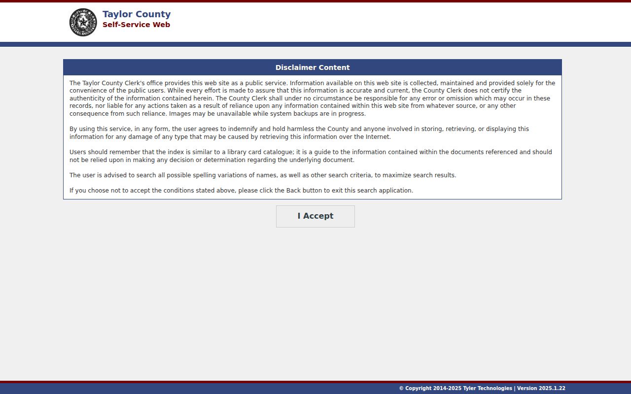
The portal's disclaimer is important: confirm a result with the clerk and do not treat an index image as a certified record.
The counter is a real fallback when the online trail stops. Taylor County provides eight Official Public Records terminals and two court terminals, with free viewing. When all stations are occupied, the county applies a 15-minute computer limit. The clerk can provide copies at $1 per page, with $5 added for a certified document; email and fax copies follow separate listed charges. The clerk does not perform real-property research for a requester, so bring the parcel, legal-description, or recording clues gathered from the street search. Call 325-674-1202 before travel, especially while county office locations are being updated.
Check Abilene Street Activity
A street address can also lead to city permit, inspection, occupancy, code, and report activity. Building Inspections links past building and permit data to MyGov and can answer channel questions at 325-676-6273. The City Secretary's records process accepts existing-record requests through NextRequest, email, or an approved in-person channel. Give the custodian a date, address, report, or other locating detail.
For an address-assignment question, use the city's 9-1-1 address request route. The linked Survey123 form was not field-inspected, so its exact fields remain a research gap. City Planning, not a postal label, supplies the relevant jurisdiction and land-use map context.
Read Abilene Street Cross-Streets
When the target is historic, the Abilene street directory has a different purpose. The 1901 volume uses block intervals such as bt. 2 and 3, while later directories use other abbreviations and household conventions. Compare an address with cross streets, spouse or family notation, occupation or business line, and the directory year. Those details can turn an old street reference into a testable parcel or deed clue.
Digitized directory pages and OCR are available through the Abilene Public Library partner collection, while the Main Library offers microfilm readers and genealogy materials. The historical shelf is treated in depth in the Abilene city directory; use it when the task becomes a household trail across years.
Resolve an Abilene Street Gap
No official source located a citywide Abilene street-renumbering table or a definitive renamed-street list. That absence matters. Do not manufacture a conversion date when an old number will not resolve. Instead, compare the legal description, plat, Sanborn sheet, directory cross-street notation, city map records, and deed chain.
Older property records can fall before the online index cutoff. The fallback chain is the County Clerk's hand indices and terminals, the FamilySearch Taylor deed catalog, the Main Library's local-history room, tax-roll microfilm, directories, Sanborn maps, and newspaper address notices. Call the clerk before an in-person visit because the February 2026 county move notice lists the 1915 courthouse at 301 Oak Street while some department pages still show suite addresses at 300 Oak Street.
Note: A failed online address match can reflect older indexing, changed numbering, or a variant description, not proof that the property lacks a record.
Define Abilene Street Record Terms
Use the same words the custodians use when notes move between a map, CAD card, and deed index. That prevents a mailing contact from being mistaken for a physical location or a historic directory clue from being treated as a current record.
- Parcel
- A mapped land unit identified by an appraisal or geographic ID. CAD data is not a legal survey.
- Situs address
- The physical location assigned to a parcel or improvement.
- Legal description
- The lot, block, subdivision, or metes-and-bounds wording in a recorded instrument. It is often the stable clue when an address changes.
- Plat
- A recorded map that can connect lot-and-block wording to a street layout.
- Criss-cross directory
- A reverse-style address aid used to connect a street and number with historical household clues.
For an older Abilene street entry, move from a cross-street interval to a plat and legal description before deciding that a present-day number is the same property.
Limits of an Abilene Street Directory
An Abilene street directory cannot show every household member, visitor, protected voter, or unrecorded occupant. A CAD owner might be an owner, tax-mail recipient, or entity with a mailing address away from the parcel. A voter file can omit unregistered people and shield protected participants. A directory entry is a dated historical clue, not proof of present occupancy.
Texas election guidance protects Social Security, driver-license, and personal-identification numbers, and the state's Address Confidentiality Program can provide a substitute address for qualifying survivors. An absent or redacted address can reflect lawful protection, different mailing information, nonregistration, or incomplete indexing. Do not infer a private location from indirect clues.
Lawful use. Use Abilene street records for personal research, family history, property questions, civic transparency, or lawful safety awareness. Do not stalk, harass, threaten, or expose a protected person.