
Find Abilene Neighbors by Block
A block lookup combines adjacent parcel and civic clues. It starts with a single address, then separates each parcel from the next. Taylor CAD can supply a parcel and appraisal clue, the city map can add boundary context, the clerk index can explain the legal chain, and a directory can supply dated household evidence. Each source has a limit, so the strongest result describes the source rather than claiming every neighbor has been found.
| Block source | What it shows near an address | Access path |
|---|---|---|
| Taylor CAD | Parcel IDs, owner/property clue, situs or mailing distinction, and appraisal fields where shown | Free search; live result schema needs verification |
| City GIS | Adjacent parcel and civic context, city limits, planning layers, and super-neighborhood context | Free web map; popup fields were not captured |
| Taylor County OPR | Deed, plat, restriction, lien, release, and legal-description chain for separate parcels | Tyler index, clerk terminals, and certified-copy route |
| MyGov | Permit, inspection, occupancy, code, or report activity tied to an address | Public landing page; city request fallback |
| Texas voter file | Governed registered-voter rows by county or precinct | Paid state request, not a free block roster |
| Directories and newspapers | Historic occupants, cross-street references, and dated local context | Library, UNT, and card-mediated databases |
Owners and occupants are different questions. A CAD owner may be a tax-mail recipient, an entity, or a person away from the site. A historic directory may name an earlier household. Neither should be restated as a list of all Abilene neighbors.
Map an Abilene Block by Parcel
The adjacent-parcel method avoids turning a map into a guess. Begin with one CAD property or visible parcel, write down the identifier and address, then inspect the surrounding parcels one at a time. The City GIS viewer is useful for geography, while CAD remains the verified appraisal and property-search route. The public inspection did not reveal the exact GIS identify control or the order of a selected parcel's fields.
- Locate the starting address in Taylor CAD and note the property ID, geographic ID, situs address, mailing address if displayed, and legal-description clue.
- Open the City of Abilene GIS viewer. Check the surrounding shapes and civic layers, including city-limit or planning context when available.
- Return to CAD and run a separate search for each adjacent parcel. Keep each record separate instead of copying a map label across the block.
- For a legal history, search the relevant owner names and legal descriptions in the clerk index. For older household context, pair the parcel with a dated directory or newspaper reference.
The Abilene street directory follows the fuller address-to-deed chain for an entire named street. A block question stays narrower: the adjoining parcels and their documented context.
Place Abilene Neighbors in Civic Layers
City Planning publishes the official map subjects for super-neighborhood boundaries, the Carver neighborhood plan, city limits, the extraterritorial jurisdiction, county boundaries, land use, corridor overlays, and other planning context. Those boundaries can help describe where an address sits in relation to an Abilene civic area. They are not evidence of association membership or a public contact list.
The Abilene Planning Services map list is the source for these public layers.

Use a planning layer to understand block context, then verify a property-specific question through the appropriate custodian rather than treating a map boundary as a roster.
Note: The researched GIS viewer did not expose live selected-parcel fields, so record the layer name and source date during a live review.
Check Abilene Neighbor Association Records
The Texas HOA management-certificate search gives Abilene neighbors a narrow official association layer. It can be filtered by HOA Name, County, City, ZIP, and Type, and its result rows open management-certificate PDFs. State search results can locate a recorded association document, not its members, residents, private roster, block-watch list, congregation directory, or civic-club membership list.
| Observed Abilene-area association | ZIP shown | Official contact or list status |
|---|---|---|
| Faculty Row Homeowners Association | 79606 | Certificate route; no public roster located |
| Hunter's Landing Owners' Association | 79602 | Certificate route; no public roster located |
| The Harvest POA | 79606 | Certificate route; no public roster located |
| Highland Farms HOA | 79606 | Certificate route; no public roster located |
| Napa Cottages HOA | 79601 | Certificate route; no public roster located |
| Carriage Hills | 79602 | Certificate route; no public roster located |
| Lone Star Ranch POA | 79604 | Certificate route; no public roster located |
| ECW Property Owner's Association | 79605 | Certificate route; no public roster located |
A screenshot of the official Texas HOA certificate search shows its search surface for association records.
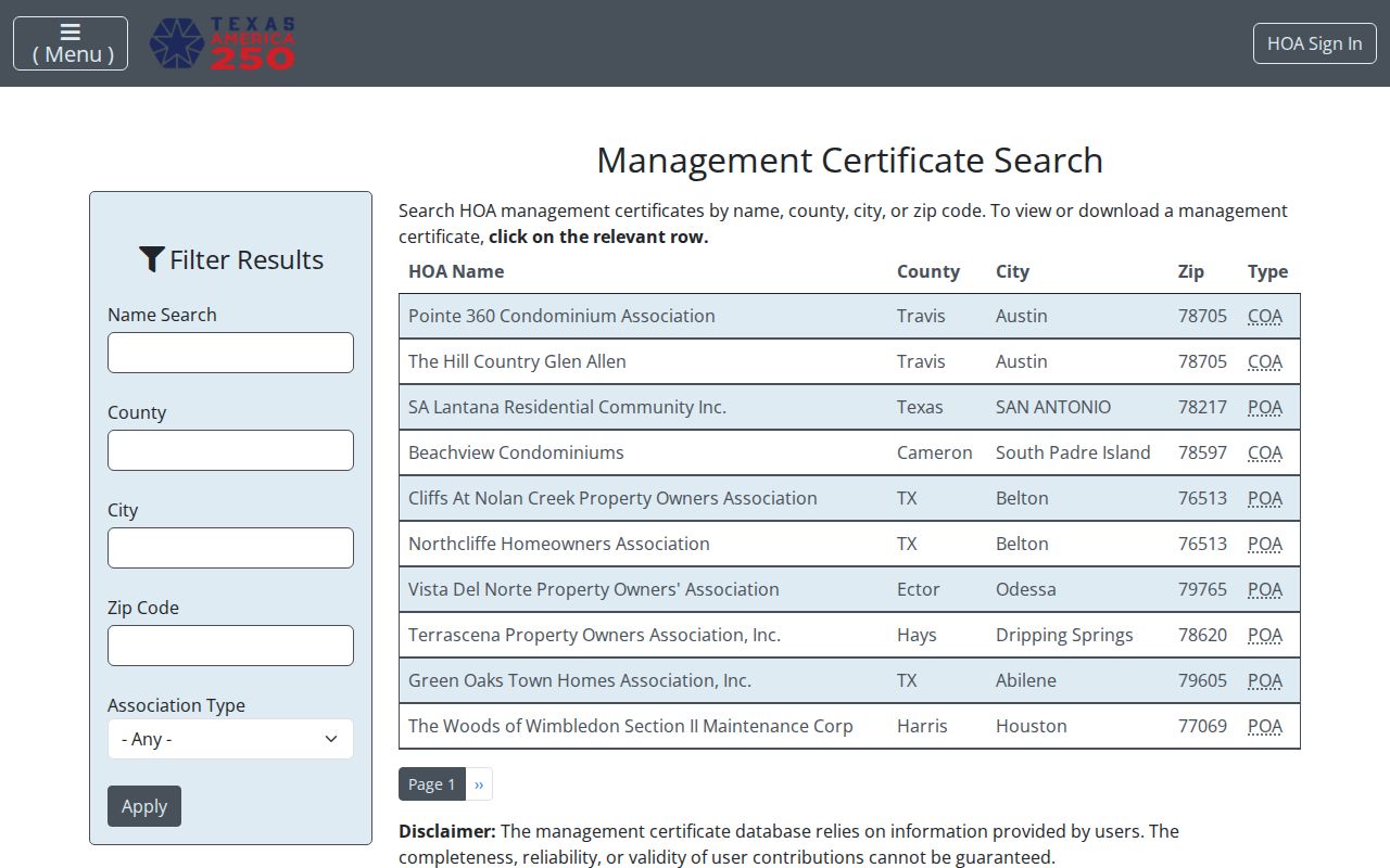
The state warns that submitted information may not be complete or reliable. Verify an association document directly, and do not equate a certificate with a member directory.
Read Abilene Neighbor Voter Limits
Texas does not offer a free public block-only voter search. The Secretary of State public-file request supports county and precinct selection, Texas mailing-address reduction, and city and ZIP fields in a fixed-width record layout. A researcher may use an address and precinct as a geographic clue, then request only the necessary fields through the official paid process. The request does not establish that every person on a block is registered or that every registered voter lives at a particular parcel.
The Texas voter-data request form documents the affidavit, deposit, delivery, and county-or-precinct route. Protected voters, address-confidentiality participants, unregistered people, suspense records, and people with a different mailing address all limit what a block result can show.
Note: A voter-file row is governed election data and a geographic clue, not a complete household record or a substitute for parcel research.
Compare Abilene Neighbor Source Types
Official sources and commercial people-finder tools serve different purposes. The official path identifies the custodian, date, and record type, allowing a reader to check the original source. Commercial compilations may mix stale, mismatched, or incomplete data and have their own notice-and-removal processes. Neither category turns a block into a full resident list.
| Source category | Strength for a block question | Limit to keep in view |
|---|---|---|
| Official parcel, deed, planning, and voter records | Named custodian, defined record purpose, and available source trail | Each record has its own scope, timing, and privacy rules |
| Official HOA management certificates | Association name, location clue, and recorded-certificate route | Not a membership or resident roster |
| Commercial people-finder category | May offer a starting clue to verify independently | Can be stale, merged, incomplete, or subject to separate removal procedures |
For public records, confirm the result with Taylor CAD, the clerk, City Planning, or the state office that holds it. A privacy removal request to a commercial service does not erase an official record held by its lawful custodian.
Add Time to Abilene Blocks
A block can look different across record eras. Taylor County reports more than four million record images, including deeds, plats, liens, restrictions, and releases, so an address search may lead beyond a current parcel card. The online property index is described from about 1972 or 1973 to current, with older property work often requiring hand indices and staff assistance. A plat or legal description can anchor an older street reference when the number no longer resolves.
For historic occupants, use directories, newspapers, tax rolls, Sanborn maps, and the Main Library's genealogy materials as corroborating sources. Their sequence matters: a directory or newspaper can date a household clue, while the deed chain identifies a property trail. No official source located a complete historic or current Abilene block roster.
Reach Abilene Block Record Custodians
When an online result stops short, use the channel matched to the record. CAD, City GIS, Tyler OPR, MyGov, planning maps, the state HOA search, voter-file request, directories, and newspapers are the documented online routes. In person, the CAD office, County Clerk terminals, Main Library, City Planning, and City Secretary are the relevant local stops. A certificate may supply association contact information only where the certificate itself does so.
By phone, the research lists CAD at 325-676-9381, the County Clerk at 325-674-1202, Planning at 325-676-6237, and the Main Library at 325-676-6328. For existing city GIS, permit, code, or administrative records, use a city or county request channel; for county instruments, use the clerk copy-request process; for voter data, use the SOS form. Sanborn maps, directories, newspapers, tax rolls, plats, and deeds remain the historical fallback.
Note: A request should identify an existing record and the responsible custodian, not ask an office to assemble an unverified neighbor list.
Define Abilene Neighbor Map Terms
Clear record terms help keep the block method honest. They describe a physical parcel, a map context, or a recorded legal clue, not an assumption about everyone who may be present nearby.
- Parcel
- A mapped land unit identified by an appraisal or geographic ID. CAD data is not a legal survey.
- Situs address
- The physical location assigned to a parcel or improvement.
- Mailing address
- The place for notices, which can differ from the situs address.
- Legal description
- Recorded lot, block, subdivision, or metes-and-bounds language that can remain stable as street information changes.
- Super-neighborhood
- A city planning boundary used for civic map context, not proof of association membership.
For Abilene neighbors, an association certificate can name an organization while a super-neighborhood map simply supplies civic context. Neither proves that a person belongs to either group.
Respect Abilene Neighbor Privacy
Public block sources leave important information private. Household members, visitors, protected voters, unregistered people, and people using a different mailing address may not appear in the records described here. A redacted or missing address can reflect legal protection, not an invitation to infer it through another source.
The Texas Address Confidentiality Program can provide qualifying survivors with a substitute PO box and mail forwarding. Texas election guidance also protects Social Security, driver-license, and personal-identification numbers. City requests can be redacted under other law. Respect those boundaries and use the underlying record only for its documented purpose.
Lawful use. Use Abilene neighbor records for personal research, family history, property questions, civic context, or lawful safety awareness. Do not stalk, harass, threaten, or expose a protected person.